
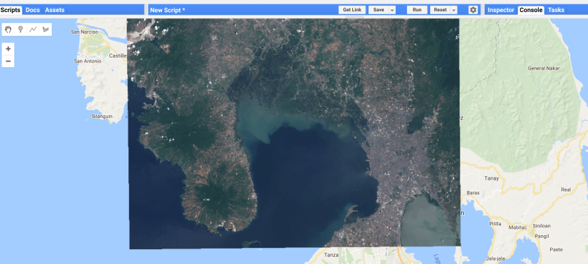
Sentinel 2 image of Manila
Step 1: add the images.
// define images
var img1 = ee.Image("COPERNICUS/S2/20180523T021649_20180523T022821_T51PTS");
var img2 = ee.Image("COPERNICUS/S2/20180319T021601_20180319T022847_T51PTS");
Step 2: Print the image properties
// print image properties
print(img1);
print(img2);
Step 3: add the images to the map
// add image as layer
Map.addLayer(img1,{bands:"B4,B3,B2",min:0,max:3000},"sentinel 2 image1");
Map.addLayer(img2,{bands:"B4,B3,B2",min:0,max:3000},"sentinel 2 image2");
Question 1: What dates are the images taken.
Question 2: Add the date of the image to the layer information.
Question 3: What is the cloud cover on both images.
