

Processing Synthetic Aperture Radar data
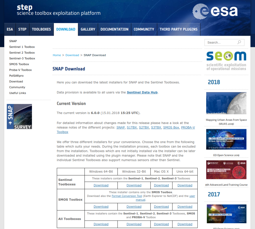
1. Download and Install SNAP from here
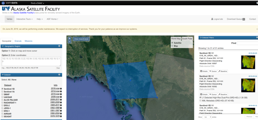
2. Download three Sentinel-1 scenes
You can download data from the Alaska Satellite Facility
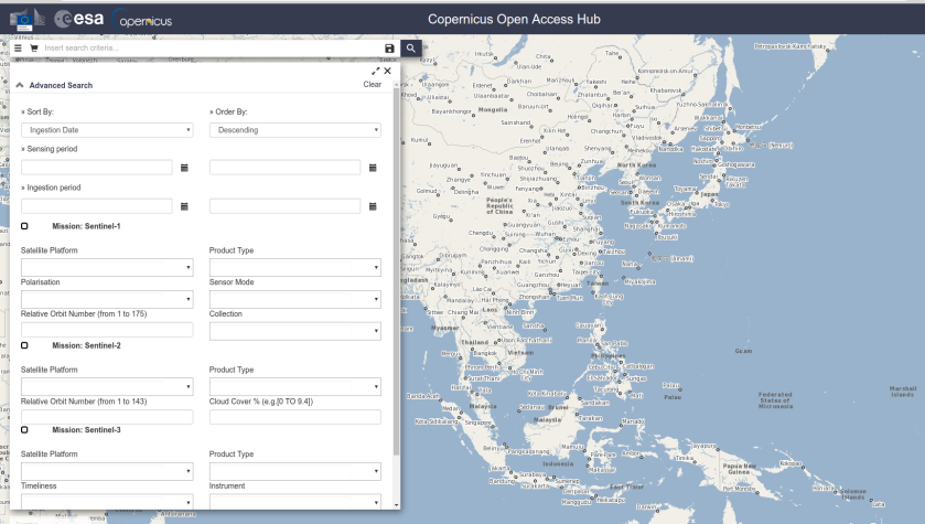
or from Copernicus website
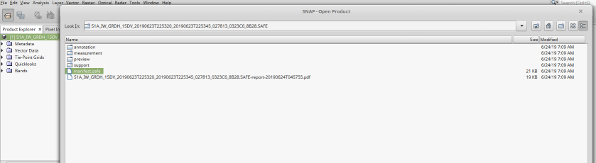
4. Open the files in SNAP
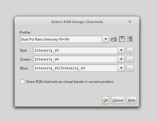
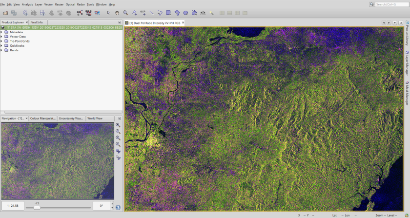
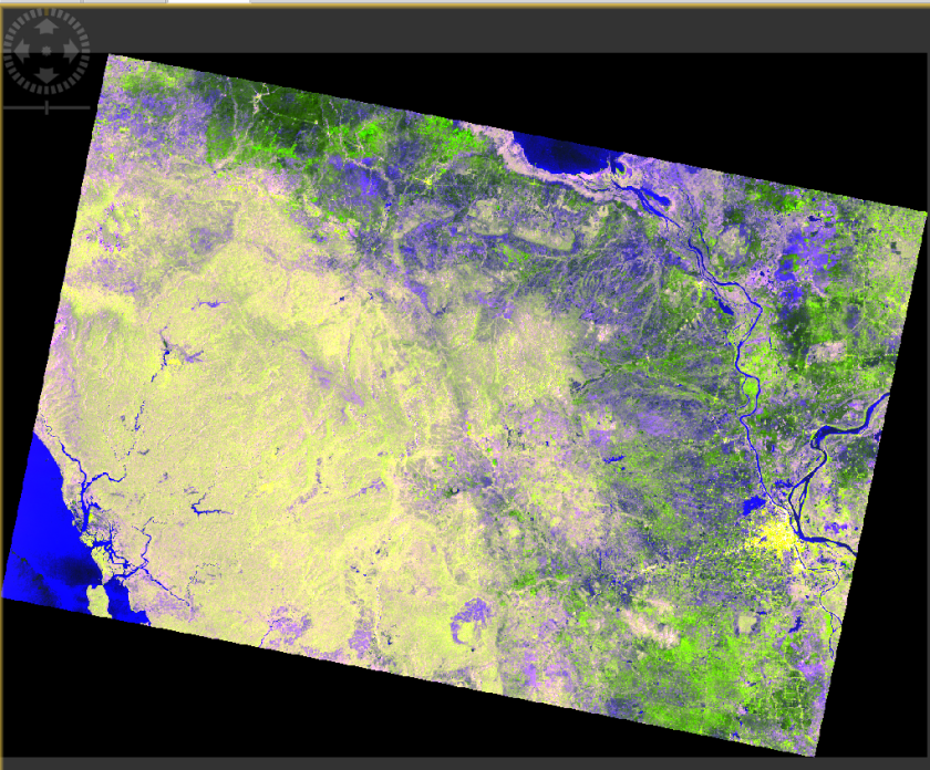
5. Display image (left click and Open RGB image window)
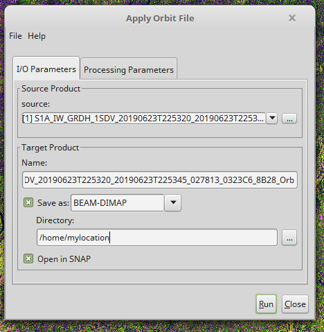
6.To apply precise orbits you need to Apply orbit files. You can use the default settings.
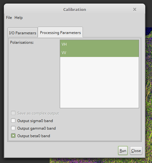
7. Apply Radiometric Calibration
To correctly apply the Radiometric Terrain Flattening correction, the image information needs to be calibrated.
Radar -> radiometric -> calibration
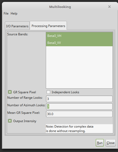
8. apply multilooking
Depending on the resolution of the DEM that can be found for your area of interest, the SAR data may have to be multilooked (reduced in resolution) before processing. If the DEM is of lower resolution than the SAR data, SNAP will enforce multilooking to the resolution of the DEM before RTC processing can be applied.
Radar -> multilooking
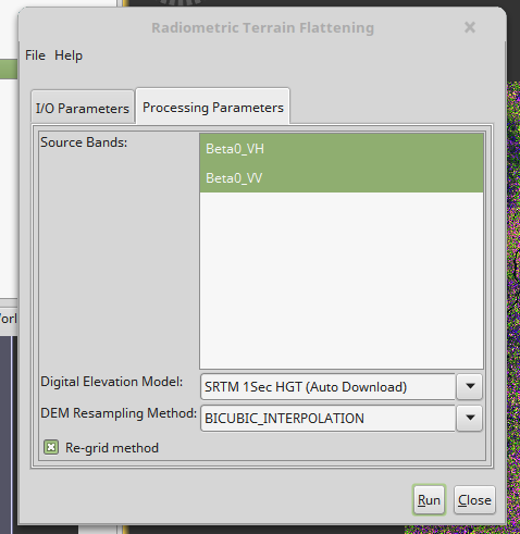
9. Apply terrain flattening
This step will remove most of the radiometric distortions from the data that are introduced by surface topography.
Radar -> radiometric -> radiometric terrain correction
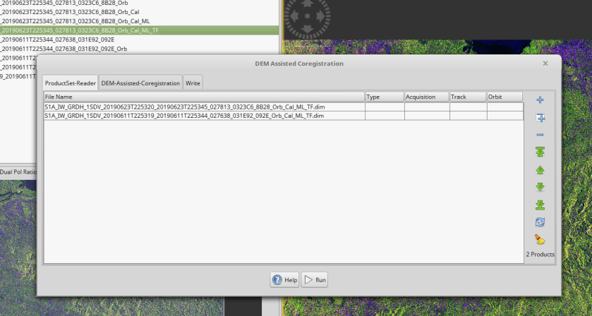
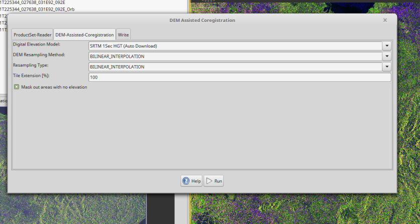
10. Coregister the stack
For interferometric processing, two or more images must be co-registered into a stack. One image is selected as the master and the other images are the slaves. The pixels in slave images will be moved to align with the master image to sub-pixel accuracy. For TOPSAR InSAR, Sentinel-1 TOPS Coregistration should be used.
Radar -> coregistration -> DEM-Assisted Coregistration ->DEM-Assisted Coregistration
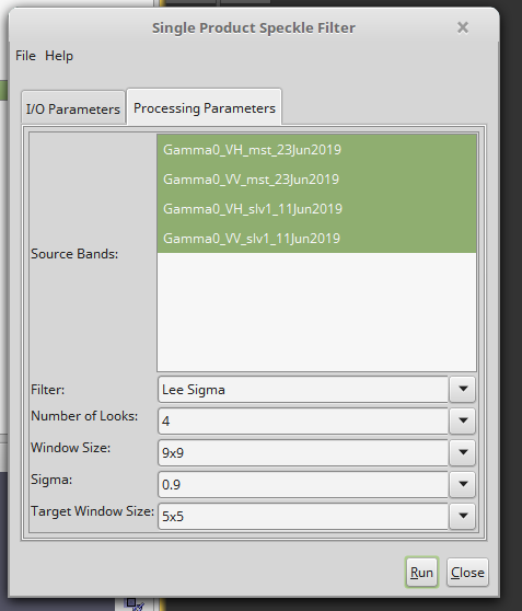
11. Apply Speckle Filter
SAR images are characterized by a somewhat grainy appearance that resembles “salt and pepper” noise. The speckle effect is inherent to all narrow-banded coherent imaging systems and is a result of interference from the many scattering echoes within a resolution cell.
Radar -> Speckle Filtering -> Single Product Speckle Filter
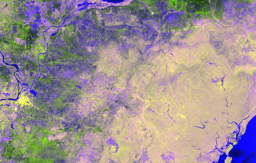
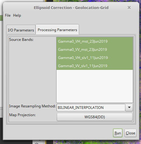
12. Orthorectify
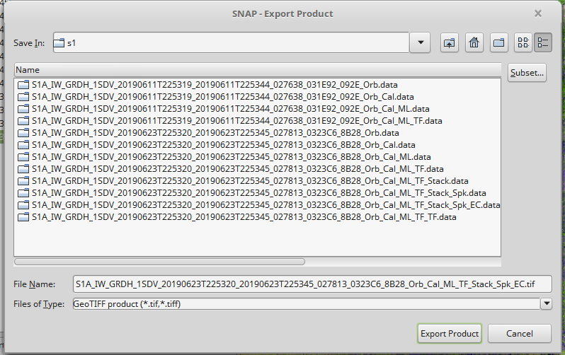
13. Export image

its wow!.. keep up!
LikeLike