
working with image collections
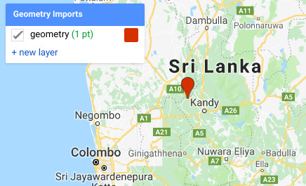
step 1: add a marker to the map
Step 2: copy the code below
// import image collection
var l8 = ee.ImageCollection("LANDSAT/LC08/C01/T1_SR");
// filter for location
l8 = l8.filterBounds(??);
// print number of images
print(l8.size());
// filter for date;
l8 = l8.filterDate("??","??")
// print number of images
print(l8.size());
// sort based on cloud cover
l8 = l8.sort("CLOUD_COVER");
// print the image collection
print(l8);
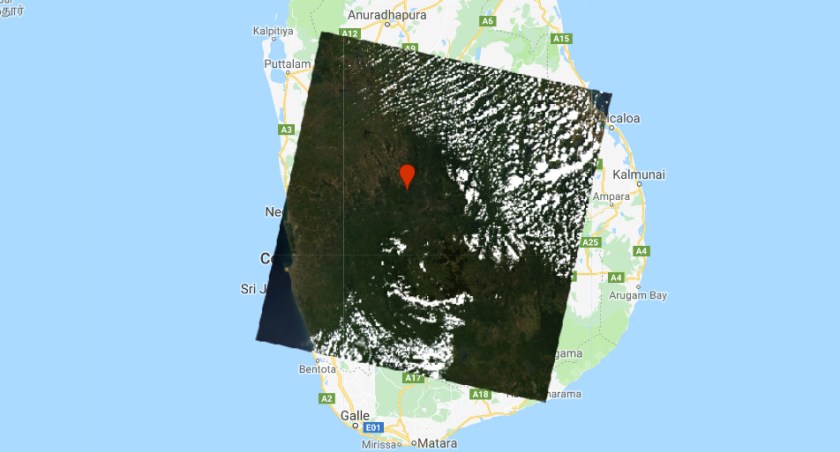
// add first image to map
Map.addLayer(ee.Image(l8.first()),{min:0,max:3000,bands:"B4,B3,B2"});
Questions:
1. What sensor is used?
2. How many images are in the in the image collection?
3. What does filterBounds do?
4. What does the sort algorithm do?
