Skip to content

Open Geo Blog

— Tutorials, Code snippets and examples to handle spatial data —

    Category: Landsat

    Vectorize reservoir in GEE

    April 21, 2017 mygeoblog

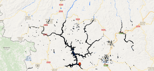
    Vectorize a watermask to create a shapefile of a lake.

    Continue reading
    Categories

    • Artificial intelligence (26)
    • chirps (5)
    • GIS (51)
    • Google Earth Engine (17)
    • Javascript (247)
    • Landsat (1)
    • MODIS (17)
    • Python (22)
    • QGIS (9)
    • R (2)
    • Remote sensing (151)
    • Sentinel 1 (18)
    • Sentinel 2 (5)
    • SNAP (1)
    • SRTM (7)
    • TauDEM (1)
    • TRMM (10)
    • Uncategorized (1)
    • Vietnamese (14)

    Top Posts & Pages

    • Working with temperature data in GEE
      Working with temperature data in GEE
    • Display maps with the GEE python library
      Display maps with the GEE python library
    • Calculate the Budyko curve in the GEE
      Calculate the Budyko curve in the GEE
    • Floods around Phitsanulok
      Floods around Phitsanulok
    • working with landcover data
      working with landcover data
    • Flood mapping with sentinel 2 in the earth engine
      Flood mapping with sentinel 2 in the earth engine
    • Defringe images from Landsat 7
      Defringe images from Landsat 7
    • Cambodia 2: Flood mapping using sentinel 2
      Cambodia 2: Flood mapping using sentinel 2
    • Working with TRMM rainfall data
      Working with TRMM rainfall data
    • Calculate Blue and Green water in GEE
      Calculate Blue and Green water in GEE
    Website Powered by WordPress.com.
    • Subscribe Subscribed
      • Open Geo Blog
      • Join 184 other subscribers
      • Already have a WordPress.com account? Log in now.
      • Open Geo Blog
      • Subscribe Subscribed
      • Sign up
      • Log in
      • Report this content
      • View site in Reader
      • Manage subscriptions
      • Collapse this bar