
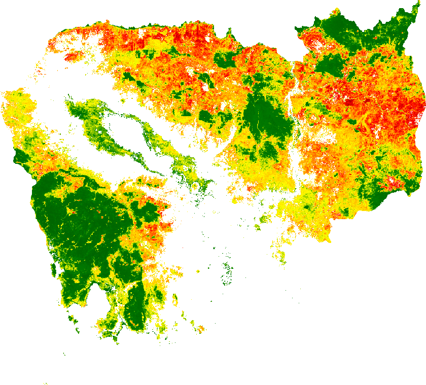
Machine learning to track calculate deforestation risk
we recently published the paper above.
We used the data from the paper to analyse change probability and deforestation. Red color indicates a high risk of deforestation, green colors a low risk (white areas are not forests). We can see the forest patches go from green to red and then disappear..

Could you share me your GEE code? Thanks.
LikeLike
Very intersecting, Could you share me your GEE code? Thanks.
LikeLike
+1
LikeLike
Could you share me your GEE code? Thanks.
LikeLike