

Upload shapefiles as fusion tables and use them in the GEE.
Google Fusion Tables is a cloud-based service for data management and integration. Fusion Tables enables users to upload tabular data files (spreadsheets, CSV, KML), currently of up to 100MB. The system provides several ways of visualizing the data (e.g., charts, maps, and timelines) and the ability to filter and aggregate the data. It supports the integration of data from multiple sources by performing joins across tables that may belong to different users. Users can keep the data private, share it with a select set of collaborators, or make it public and thus crawlable by search engines. The discussion feature of Fusion Tables allows collaborators to conduct detailed discussions of the data at the level of tables and individual rows, columns, and cells. This paper describes the inner workings of Fusion Tables, including the storage of data in the system and the tight integration with the Google Maps infrastructure.
1. Download these data and unzip it.
2. Open the data in Qgis.
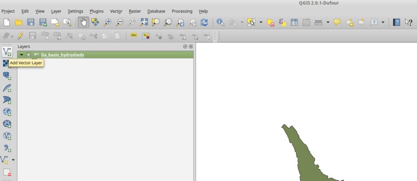
3. Click right on the layer and select save as.
4. Save the data as a KML file.

5. Go to this website.
6. Click CREATE A FUSION TABLE and follow all steps to upload the KML file.
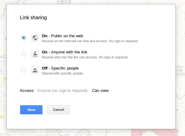
7. Click the share button in the right top and share the data using a link.
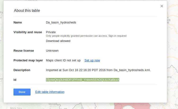
8. Copy the table id in the menu File -> about this table.
9. Import the data into the GEE (example).

where can I find alternative website that I can easily upload shapefiles as fusion tables and use them in the GEE? Thanks.
LikeLike
I no longer believe fusion tables are used in GEE. Your code editor example returns an error. An update to this post would be much appreciated.
LikeLike
Hi thanks for postingg this
LikeLike