
Identify paddies or flooded areas with SAR.
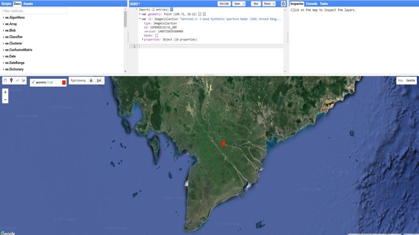
Step 1: Place a marker in the Mekong delta and import the Sentinel-1 image collection. Call the marker roi and the sentinel collection s1.
Step 2: Select the high and low values in the image collection. We call them wet and dry.
// filter on location
var collection = s1.filterBounds(roi)
.select('VV');

var viz = {min:-20, max:0, palette:['FFFFFF,000000']};

// create a map of the wet and dry conditions
var wet = collection.filterDate('2014-01-01', '2016-12-31').reduce(ee.Reducer.percentile([10]));
var dry = collection.filterDate('2014-01-01', '2016-12-31').reduce(ee.Reducer.percentile([90]));
Map.addLayer(wet,viz,"Wet");
Map.addLayer(dry,viz,"Dry");
Step 3: Subtract the dry from the wet map.
var diff = wet.subtract(dry)
Map.addLayer(diff,viz,"wet -  dry");
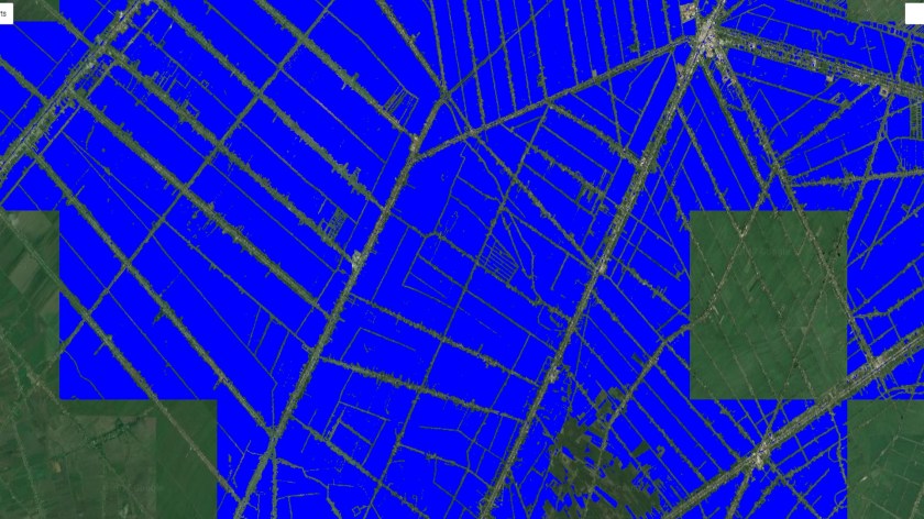
Step 4:Use a threshold to identify water areas.
// set the threshold
var value = ??

// select areas smaller than the threshold
var diff_thresholded = diff.lt(value);

// Add to map
Map.centerObject(roi, 8);

Map.addLayer(diff_thresholded.updateMask(diff_thresholded),
{palette:"0000FF"},'flooded areas - blue',1);
See an example here.
