
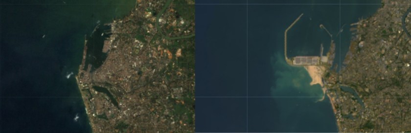
Analyse changes using satellite images.
Add the right bands to display the images
var img = ee.Image("LANDSAT/LC08/C01/T1_SR/LC08_141055_20170113");
print(img);
Map.addLayer(img,{min:0,max:3000,bands:"??,??,??"},"???");

var img = ee.Image("LANDSAT/LT05/C01/T1_SR/LT05_141055_19881215");
print(img);
Map.addLayer(img,{min:0,max:3000,bands:"??,??,??"},"???");
Questions:
1. What satellites were used to obtain these images?
2. Why do you need to use different bands to display the images?
3. What are the exact dates of the images?
4. What is the amount of cloud cover in the images?
