A single satellite image is represented as an ee.Image() object.
In the example below two images are imported using ee.Image().
// User specified parameters
// create vizualtion settings
var vizl5 = {min:0, max:0.3,bands:['B4', 'B3', 'B2']};
var vizl8 = {min:0, max:0.3,bands:['B5', 'B4', 'B3']};
// Data
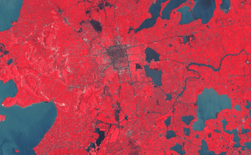
var img1984 = ee.Image("LANDSAT/LT5_L1T_TOA_FMASK/LT51190381984217HAJ00");
var img2013 = ee.Image("LANDSAT/LC8_L1T_TOA/LC81190382013104LGN01");
// Add to map
Map.addLayer(img1984,vizl5,"1984 image");
Map.addLayer(img2013,vizl8,"2013 image");

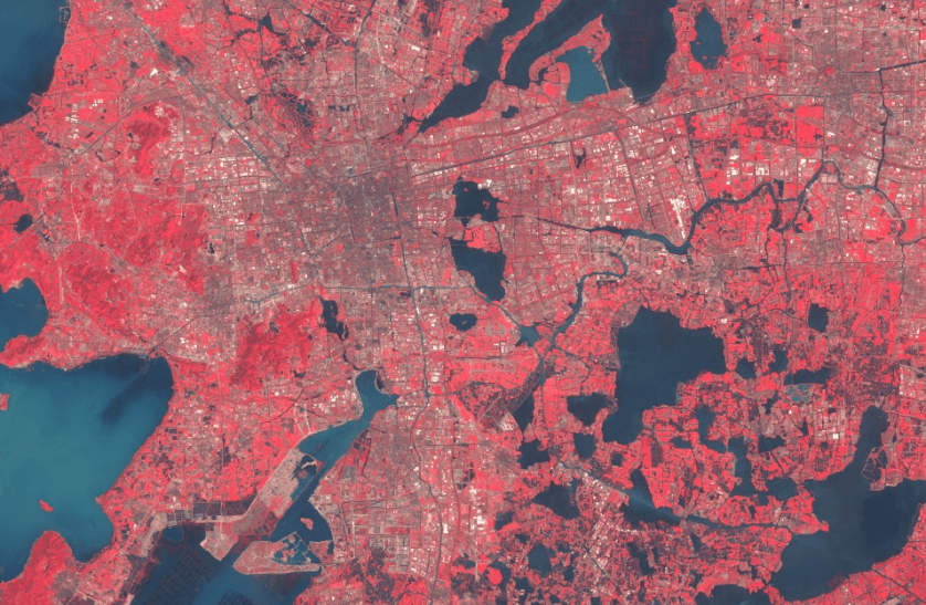
The Chinese city Suzhou in 1984 and 2013. Suzhou is one of the fastest growing cities in the world
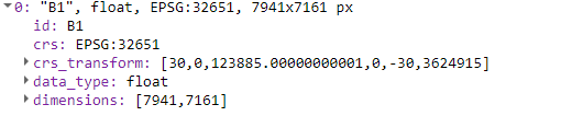
Metadata is attached to every images. Images contain an id, version and properties. The bands can be found under bands.
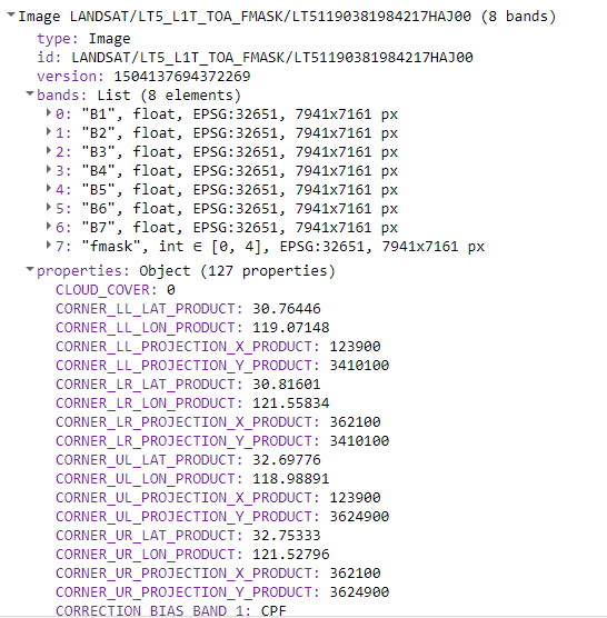
Each band has it’s own metadata