
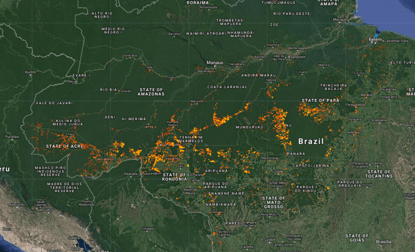
Maps from the Fire Information for Resource Management System
The Earth Engine version of the Fire Information for Resource Management System (FIRMS) dataset contains the LANCE fire detection product in rasterized form. The near real-time (NRT) active fire locations are processed by LANCE using the standard MODIS MOD14/MYD14 Fire and Thermal Anomalies product.
use the code below or click here
var amazonia = ee.FeatureCollection("users/servirmekong/Temp/amazonia")

var dataset = ee.ImageCollection('FIRMS').filter(
ee.Filter.date('2019-08-01', '2019-08-26'));

var fire = dataset.select('T21').max();

Map.addLayer(fire.clip(amazonia), {min:300,max:400,palette:['red', 'orange', 'yellow']}, 'Fires');
