
Investigate location and extent
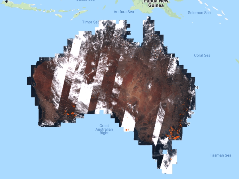
In this example we use data from Sentinel-2 and the Fire Information for Resource Management System (FIRMS) data product.

// import sentinel-2 data
var s2 = ee.ImageCollection("COPERNICUS/S2");
// import firms data
var firms = ee.ImageCollection("FIRMS");
// import administrative data
var countries = ee.FeatureCollection("USDOS/LSIB_SIMPLE/2017");

// filter for australia
var australia = countries.filter(ee.Filter.eq("country_na","Australia"));

// filter for relevant time period
s2 = s2.filterBounds(australia).filterDate("2020-01-05","2020-01-12");
firms =firms.filterBounds(australia).filterDate("2020-01-01","2020-01-12");

// show the data
Map.addLayer(s2,{min:0,max:6000,bands:"B4,B3,B2"},"true color");
Map.addLayer(s2,{min:0,max:6000,bands:"B11,B8,B4"},"false color");
Map.addLayer(firms.max(),{min:0,max:500,bands:"T21",palette:"yellow,orange,red"},"Brightness temperature");
