
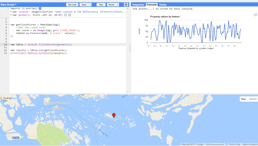
Make a chart with cloud cover in each image.
Step 1: Add a marker to the map
Step 2: Import the USGS Landsat 8 TOA Reflectance (Orthorectified) with Fmask
Step 3: copy the code below and run the script.
var getCloudScores = function(img){
//Get the cloud cover
var value = ee.Image(img).get('CLOUD_COVER');
return ee.Feature(null, {'score': value});
};
var l8toa = landsat.filterBounds(geometry);

var results = l8toa.map(getCloudScores);
print(Chart.feature.byFeature(results));
Have a look here.
