
Download a Hydrologically Conditioned DEM.
1. Import the WWF HydroSHEDS Hydrologically Conditioned DEM, 30 arc-second.
2. Run the script.
3. Go to tasks and hit run.
4. Download the file from your Google Drive.
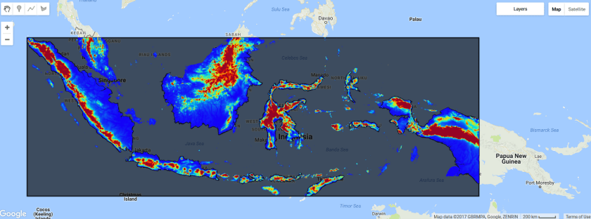
This script.
// Specify Country names
var country_names = ['Indonesia'];

// Get the country boundaries
var countries = ee.FeatureCollection('ft:1tdSwUL7MVpOauSgRzqVTOwdfy17KDbw-1d9omPw');

// Filter for country
var Indonesia = countries.filter(ee.Filter.inList('Country', country_names));

// Get the geometry
var Indonesia = Indonesia.geometry();

// Get the bounds
var IndonesiaBounds = Indonesia.bounds();

// create the vizualization parameters
var viz = {min:0.0, max:1000, palette:"1400f7,00f4e8,f4f000,f40000,960424"};

// add the country boundaries to the map
Map.addLayer(Indonesia,null,"Boundaries");

// add the bounds
Map.addLayer(IndonesiaBounds,null,"Bounds");

// add to map
Map.addLayer(dem.clip(IndonesiaBounds),viz,"Clipped DEM")

//Export the image, specifying scale and region.
Export.image.toDrive({
image: dem,
description: 'Indonesia',
scale: 1000,
region: IndonesiaBounds
});

Great article thanks for this. I just want to know why are we specifying scale 1000 and if we reduce it to say 30m what will happen
LikeLike