USGS Landsat 8 Collection 1 Tier 1 and Real-Time data TOA Reflectance (Orthorectified)

Yeah! new data!

step 1: Import the image collection.

step 2: Draw a geometry.landsatrealtime.png

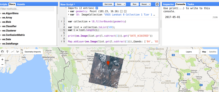
Step 3: use the code below:
 

var collection = l8.filterBounds(geometry)

var list = collection.toList(500);
var l = list.length();

print(ee.Image(list.get(l.subtract(1))).get("DATE_ACQUIRED"))

Map.addLayer(ee.Image(list.get(l.subtract(1))),{bands: ['B4', 'B3', 'B2'], max: 0.3},"mymap")

Follow this link.

Leave a Reply

Fill in your details below or click an icon to log in:

WordPress.com Logo

You are commenting using your WordPress.com account. Log Out /  Change )

Facebook photo

You are commenting using your Facebook account. Log Out /  Change )

Connecting to %s