
Worldpop is a great open access population distribution dataset.
High resolution, contemporary data on human population distributions are a prerequisite for the accurate measurement of the impacts of population growth, for monitoring changes and for planning interventions.
The WorldPop project aims to meet these needs through the provision of detailed and open access population distribution datasets built using transparent and peer-reviewed approaches.
Worldpop uses recent census-based population counts matched to their associated administrative units are disaggregated to ≈100x100m grid cells through machine learning approaches that exploit the relationships between population densities and a range of geospatial covariate layers. The datasets depict estimated numbers of people residing in each grid cell in 2010, 2015, and other years.
Find an example to use Worldpop data below:
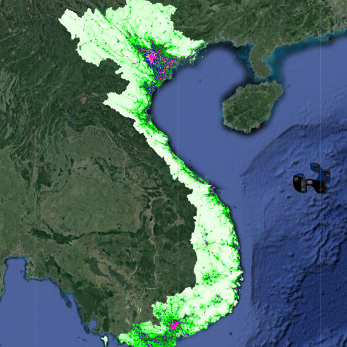
var WP_2010  = worldPop
.filter(ee.Filter.inList('country', ['VNM']))
.filter(ee.Filter.equals('UNadj', 'no'))
.filter(ee.Filter.equals('year', 2010))
.select('population');

var pop2010 = WP_2010.mosaic()
.select('population')
.rename('pop2010')
.set('system:time_start',ee.Date.fromYMD(2010,1,1));

var viz = {min:0.0, max:20, palette:"F3FEEE,00ff04,075e09,0000FF,FDFF92,FF2700,FF00E7"};

Map.addLayer(pop2010,viz)
See an example here.
