
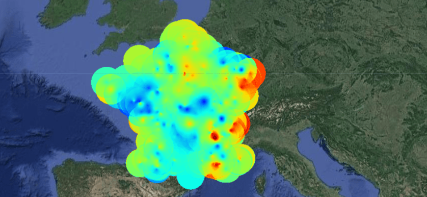
Kriging is a geostatistical method that generates an estimated surface from a set of points.
See an example below and here.
// User specified parameters
var colors = ['00007F', '0000FF', '0074FF',
              '0DFFEA', '8CFF41', 'FFDD00',
              'FF3700', 'C30000', '790000'];
var viz = {min:0, max:70, palette: colors};

// Data
var samples = ee.FeatureCollection("ft:1WxQB2Ux6gDvTxLgDgpudWxrN4bt4nbtEh9Vj9FqB");

// Functions

// Interpolate SST from the sampled points.
var interpolated = samples.kriging({
  propertyName: 'val',
  shape: 'exponential',
  range: 100000,
  sill: 1.0,
  nugget: 0.1,
  maxDistance: 100000,
  reducer: 'mean',
});

// Add to map
Map.addLayer(interpolated, viz, 'Interpolated kriging pm10 France');
Map.addLayer(samples,{},"Samples");

Do you have the data used in “samples”?
LikeLike